Counties of: Emmet, Palo Alto, Kossuth, Winnebago, Hancock, Humboldt, Wright, and Pocahontas

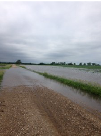
A widespread area from Storm Lake north to the Minnesota border has been affected by excessive rainfall since last weekend, with some areas receiving over 10 inches in that time period. Needless to say, most low areas are holding standing water and fields near streams and ditches have very large drowned out areas. The area north of Estherville had severe hail damage from a storm on Monday night, but otherwise hail reports have been limited, although there has been some strong winds reported with the storms. Additional rainfall we receive over the next week will determine how much crop loss is sustained from this week’s rain. A quick switch to dryer weather patterns would limit losses, but that does not seem likely at this point. The more well drained parts of the fields have improved with a return of warmer weather and plenty of moisture. The corn has a good green color and the soybeans have began a period of rapid growth.
The markets have not taken into account the excessive moisture and storm damage in Northern Iowa yet. The old saying that rain makes grain until proven otherwise is making for high crop ratings across most of the corn belt. I expect this will begin to change next week.
Please click on the links on the right to view the past pdf’s of our Northeast Crop Conditions reports.
1705 N Lake Ave
Storm Lake, IA 50588
Real Estate Licensed in Iowa, Minnesota, Nebraska and South Dakota.
Stay informed and connected—subscribe to our mailing list today to receive the latest issues of Today’s Land Owner, Crop Updates, or get notified of auctions and real estate for sale, sent directly in your inbox!